

Technical progress of satellite-borne GNSS-R monitoring sea surface targets
-
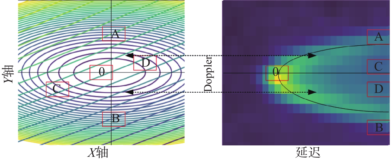
摘要: 全球卫星导航系统(GNSS)因其直射信号经海面反射后,反射信号会携带海面物理信息,由此开辟了一种在遥感应用中有巨大潜力的全球卫星导航反射信号(GNSS-R)技术,国内外在星载GNSS-R监测海面领域取得进展. 本文总结了应用星载GNSS-R数据监测海面目标的进展,然后针对星载GNSS-R监测海面目标技术从最初实验、基于延迟多普勒图(DDM)观测值监测、基于反演散射系数监测、应用神经网络监测四个方面进行了总结和归纳.
-
关键词:
- 全球卫星导航系统(GNSS) /
- 全球卫星导航反射信号(GNSS-R) /
- 延迟多普勒图(DDM) /
- 空间积分法 /
- 机器学习
Abstract: Global Navigation Satellite System (GNSS) has opened up a GNSS-reflection (GNSS-R) technology with great potential in many other remote sensing applications because its direct signal is reflected by the sea surface. Progress has been made at home and abroad in the field of on-board GNSS-R monitoring of the sea surface. This paper summarizes the progress of monitoring sea surface targets using satellite-borne GNSS-R data. The technology of monitoring sea surface targets with satellite-borne GNSS-R is summarized and summarized from four aspects: initial experiment, monitoring based on delay Doppler map (DDM) observation value, monitoring based on inverse scattering coefficient and monitoring using neural network. -
[1] MARTIN-NEIRA M. A passive reflectometry and interferometry system (PARIS): application to ocean altimetry[J]. ESA journal, 1993, 17(4): 331-355. [2] 胡媛, 陈行杨, 顾旺旺, 等. GNSS-R 海面测高现状及其常用方法研究进展[J]. 全球定位系统, 2020, 45(3): 96-103. [3] HALL C D, CORDEY R A. Multistatic scatterometry[C]// International Geoscience and Remote Sensing Symposium, ‘Remote Sensing: Moving Toward the 21st Centry’, IEEE, 1988. DOI: 10.1109/IGARSS.1988.570200 [4] SOULAT F M, GERMAIN O P, LOPEZ-DEKKER M, et al. Sea state monitoring using coastal GNSS-R[J]. Geophysical research letters, 2004, 31(21): 133-147. DOI: 10.1029/2004GL020680 [5] FABRA F, CARDELLACH E, RIUS A, et al. Phase altimetry with dual polarization GNSS-R over sea ice[J]. IEEE transactions on geoscience and remote sensing, 2012, 50(99): 2112-2121. DOI: 10.1109/TGRS.2011.2172797 [6] MARTIN-NEIRA M, CAPARRINI M, FONT-ROSSELLO J, et al. The PARIS concept: an experimental demonstration of sea surface altimetry using GPS reflected signals[J]. IEEE transactions on geoscience and remote sensing, 2001, 39(1): 142-150. DOI: 10.1109/36.898676 [7] RIVAS M B, MARTIN-NEIRA M. Coherent GPS reflections from the sea surface[J]. IEEE geoscience and remote sensing letters, 2006, 3(1): 28-31. DOI: 10.1109/LGRS.2005.855617 [8] 吴军, 张波, 洪学宝, 等. 基于北斗卫星反射信号的海面溢油探测方法及试验[J]. 北京航空航天大学学报, 2017, 43(1): 193-199. DOI: 10.13700/j.bh.1001-5965.2016.0096 [9] AUBER J-C, BIBAUT A, RIGAL J M. Characterization of multipath on land and sea at GPS frequencies[C]//The 7th International Technical Meeting of the Satellite Division of the Institute of Navigation (ION GPS 1994), 1994: 1155-1171. [10] KOMJATHY A, ARMATYS M, MASTERS D, et al. A review of airborne reflected GPS signal processing results for ocean, land and ice remote sensing applications[C]//AGU Spring Meeting Abstracts, 2001: A32C-03. [11] KATZBERG S J, WALKER R A, ROLES J H, et al. First GPS signals reflected from the interior of a tropical storm: preliminary results from Hurricane Michael[J]. Geophysical research letters, 2001, 28(10): 1981-1984. DOI: 10.1029/2000GL012823 [12] RUFFINI G, SOULAT F, CAPARRINI M, et al. The eddy experiment: accurate GNSS‐R ocean altimetry from low altitude aircraft[J]. Geophysical research letters, 2004, 31(12). DOI: 10.1029/2004GL019994 [13] YONG L, YANG D K, LI W Q, et al. Study on the new methods of ship object detection based on GNSS reflection[J]. Marine geodesy, 2013, 36(1): 22-30. DOI: 10.1080/01490419.2012.747456 [14] RODRIGUEZ-ALVAREZ N, AKOS D M, ZAVOROTNY V U, et al. Airborne GNSS-R wind retrievals using delay–doppler maps[J]. IEEE transactions on geoscience and remote sensing, 2012, 51(1): 626-641. [15] MASHBURN J, AXELRAD P, LOWE S T, et al. An assessment of the precision and accuracy of altimetry retrievals for a monterey bay GNSS-R experiment[J]. IEEE journal of selected topics in applied earth observations and remote sensing, 2016, 9(10): 4660-4668. DOI: 10.1109/JSTARS.2016.2537698 [16] KATZBERG S J, GARRISONJ L. Utilizing GPS to determine ionospheric delay over the ocean[R/OL]. [2021-03-25]. NASA Technical Memorandum, 1996. https://ntrs.nasa.gov/api/citations/19970005019/downloads/19970005019.pdf [17] LOWE S T, LABRECQUE J L, ZUFFADA C, et al. First spaceborne observation of an earth-reflected GPS signal[J]. Radio science, 2002, 37(1): 7-1-7-28. DOI: 10.1029/2000RS002539 [18] GLEASON S, ADJRAD M, UNWIN M. Sensing ocean, ice and land reflected signals from space: results from the UK-DMC GPS reflectometry experiment[C]//The 18th International Technical Meeting of the Satellite Division of The Institute of Navigation (ION GNSS 2005), 2005: 1679-1685. [19] GLEASON S. Remote sensing of ocean, ice and land surfaces using bistatically scattered GNSS signals from low earth orbit[D]. University of Surrey, 2006. [20] GLEASON S. Towards sea ice remote sensing with space detected GPS signals: demonstration of technical feasibility and initial consistency check using low resolution sea ice information[J]. Remote sensing, 2010, 2(8): 2017-2039. DOI: 10.3390/rs2082017 [21] YAN Q Y, HUANG W M. Spaceborne GNSS-R sea ice detection using delay-doppler maps: first results from the UK TechDemoSat-1 mission[J]. IEEE journal of selected topics in applied earth observations and remote sensing, 2016, 9(10): 4795-4801. DOI: 10.1109/JSTARS.2016.2582690 [22] RUF C, LYONS A, UNWIN M, et al. CYGNSS: Enabling the future of hurricane prediction remote sensing satellites[J]. IEEE geoscience and remote sensing magazine, 2013, 1(2): 52-67. DOI: 10.1109/MGRS.2013.2260911 [23] LAUGHLAND J, GROGAN P T. Analyzing the calibration and validation support architecture for CYGNSS as a design problem[C]//ASCEND, 2020: 4057. DOI: 10.2514/6.2020-4057 [24] ALONSO-ARROYO A, ZAVOROTNY V U, CAMPS A. Sea ice detection using UK TDS-1 GNSS-R data[J]. IEEE transactions on geoscience and remote sensing, 2017, 55(9): 4989-5001. DOI: 10.1109/TGRS.2017.2699122 [25] SCHIAVULLI D, FRAPPART F, RAMILLIEN G, et al. Observing sea/ice transition using radar images generated from TechDemoSat-1 delay Doppler maps[J]. IEEE geoscience and remote sensing letters, 2017, 14(5): 734-738. DOI: 10.1109/LGRS.2017.2676823 [26] HU C J, BENSON C, RIZOS C, et al. Single-pass sub-meter space-based GNSS-R ice altimetry: results from TDS-1[J]. IEEE journal of selected topics in applied earth observations and remote sensing, 2017, 10(8): 3782-3788. DOI: 10.1109/JSTARS.2017.2690917 [27] LI W Q, CARDELLACH E, FABRA F, et al. First spaceborne phase altimetry over sea ice using TechDemoSat-1 GNSS-R signals[J]. Geophysical research letters, 2017, 44(16): 8369-8376. DOI: 10.1002/2017GL074513 [28] YAN Q Y, HUANG W M. Sea ice detection from GNSS-R delay-Doppler map[C]//The 17th International Symposium on Antenna Technology and Applied Electromagnetics (ANTEM), 2016: 1-2. DOI: 10.1109/ANTEM.2016.7550123 [29] MARCHÁN-HERNÁNDEZ J F, RODRÍGUEZ-ÁLVAREZ N, CAMPS A, et al. Correction of the sea state impact in the L-band brightness temperature by means of delay-Doppler maps of global navigation satellite signals reflected over the sea surface[J]. IEEE transactions on geoscience and remote sensing, 2008, 46(10): 2914-2923. DOI: 10.1109/TGRS.2008.922144 [30] CLARIZIA M P, RUF C S, JALES P, et al. Spaceborne GNSS-R minimum variance wind speed estimator[J]. IEEE transactions on geoscience and remote sensing, 2014, 52(11): 6829-6843. DOI: 10.1109/TGRS.2014.2303831 [31] CARTWRIGHT J, BANKS C J, SROKOSZ M. Sea ice detection using GNSS-R data from TechDemoSat-1[J]. Journal of geophysical research:oceans, 2019, 124(8): 5801-5810. DOI: 10.1029/2019JC015327 [32] ZHANG G D, GUO J, YANG D K, et al. Sea ice edge detection using spaceborne GNSS-R signal[J]. Geomatics and information science of Wuhan University, 2019, 44(5): 668-674. DOI: 10.13203/j.whugis20170050 [33] VALENCIA E, CAMPS A, MARCHAN-HERNANDEZ J F, et al. Ocean surface's scattering coefficient retrieval by delay–Doppler map inversion[J]. IEEE geoence and remote sensing letters, 2011, 8(4): 750-754. DOI: 10.1109/LGRS.2011.2107500 [34] SIMONE A D, IODICE A, RICCIO D, et al. GNSS-R: a useful tool for sea target detection in near real-time[C]// The 3rd International Forum on Research and Technologies for Society and Industry - Innovation to Shape the Future for Society and Industry (RTSI), 2017. DOI: 10.1109/RTSI.2017.8065958 [35] YAN Q Y, HUANG W M. Sea ice detection based on unambiguous retrieval of scattering coefficient from GNSS-R delay-Doppler maps[C]//OCEANS-MTS/IEEE Kobe Techno-Oceans (OTO), 2018: 1-5. DOI: 10.1109/OCEANSKOBE.2018.8559148 [36] 陈闪闪, 张云, 洪中华, 等. GNSS反射信号海面溢油回波DDM仿真研究[J]. 全球定位系统, 2017, 42(3): 15-19. DOI: 10.13442/j.gnss.1008-9268.2017.03.004 [37] 刘池莉, 严颂华, 陈泽强, 等. 基于星载GNSS-R延迟-多普勒图的海面目标探测[J]. 科学技术与工程, 2018, 18(17): 250-256. DOI: 10.3969/j.issn.1671-1815.2018.17.041 [38] SCHIAVULLI D, NUNZIATA F, MIGLIACCIO M, et al. Reconstruction of the radar image from actual DDMs collected by TechDemoSat-1 GNSS-R mission[J]. IEEE journal of selected topics in applied earth observations and remote sensing, 2016, 9(10): 4700-4708. DOI: 10.1109/JSTARS.2016.2543301 [39] ZAVOROTNY V U, VORONOVICH A G. Scattering of GPS signals from the ocean with wind remote sensing application[J]. IEEE transactions on geoscience and remote sensing, 2000, 38(2): 951-964. DOI: 10.1109/36.841977 [40] RIUS A, CARDELLACH E, FABRA F, et al. Feasibility of GNSS-R ice sheet altimetry in Greenland using TDS-1[J]. Remote sensing, 2017, 9(7): 742. DOI: 10.3390/rs9070742 [41] MARCHAN-HERNANDEZ J F, CAMPS A, RODRIGUEZ-ALVAREZ N, et al. An efficient algorithm to the simulation of delay–Doppler maps of reflected global navigation satellite system signals[J]. IEEE transactions on geoscience and remote sensing, 2009, 47(8): 2733-2740. DOI: 10.1109/TGRS.2009.2014465 [42] LI C, HUANG W M. Sea surface oil slick detection from GNSS-R delay-Doppler maps using the spatial integration approach[C]//IEEE Radar Conference (RadarCon13), 2013. DOI: 10.1109/RADAR.2013.6585990 [43] LI C, HUANG W M, GLEASON S. Dual antenna space-based GNSS-R ocean surface mapping: oil slick and tropical cyclone sensing[J]. IEEE journal of selected topics in applied earth observations and remote sensing, 2015, 8(1): 425-435. DOI: 10.1109/JSTARS.2014.2341581 [44] SCHIAVULLI D, NUNZIATA F, PUGLIANO G, et al. Reconstruction of the normalized radar cross section field from GNSS-R delay-Doppler map[J]. IEEE journal of selected topics in applied earth observations and remote sensing, 2014, 7(5): 1573-1583. DOI: 10.1109/JSTARS.2014.2301019 [45] LENTI F, NUNZIATA F, MIGLIACCIO M, et al. Two-dimensional TSVD to enhance the spatial resolution of radiometer data[J]. IEEE transactions on geoscience and remote sensing, 2014, 52(5): 2450-2458. DOI: 10.1109/TGRS.2013.2261303 [46] WANG L, SCOTT K A, XU L L, et al. Sea ice concentration estimation during melt from dual-pol SAR scenes using deep convolutional neural networks: a case study[J]. IEEE transactions on geoscience and remote sensing, 2016, 54(8): 4524-4533. DOI: 10.1109/TGRS.2016.2543660 [47] SHEN X Y, ZHANG J, ZHANG X, et al. Sea ice classification using Cryosat-2 altimeter data by optimal classifier–feature assembly[J]. IEEE geoscience and remote sensing letters, 2017, 14(11): 1948-1952. DOI: 10.1109/LGRS.2017.2743339 [48] BOBYLEV L P, ZABOLOTSKIKH E V, MITNIK L, et al. Neural-Network based algorithm for ice concentration retrievals from satellite passive microwave data[C]// Microwave Radiometry and Remote Sensing of the Environment, 2008: 1-4. DOI: 10.1109/MICRAD.2008.4579499 [49] WERBOS P J. New tools for prediction and analysis in the behavioral sciences[D]. Cambridge: Harvard University, 1974. [50] MARQUARDT D W. An algorithm for least-squares estimation of nonlinear parameters[J]. Journal of the society for Industrial and applied mathematics, 1963, 11(2): 431-441. DOI: 10.1137/0111030 [51] YAN Q, HUANG W M, MOLONEY C. Neural networks based sea ice detection and concentration retrieval from GNSS-R delay-Doppler maps[J]. IEEE journal of selected topics in applied earth observations and remote sensing, 2017, 10(8): 3789-3798. DOI: 10.1109/JSTARS.2017.2689009 [52] YAN Q Y, HUANG W M. Sea ice sensing from GNSS-R data using convolutional neural networks[J]. IEEE geoscience and remote sensing letters, 2018, 15(10): 1510-1514. DOI: 10.1109/LGRS.2018.2852143 [53] CORTES C, VAPNIK V N. Support-vector networks[J]. Machine learning, 1995, 20(3): 273-297. DOI: 10.1023/A:1022627411411 [54] PAL M, MATHER P. Support vector machines for classification in remote sensing[J]. International journal of remote sensing, 2005, 26(5): 1007-1011. DOI: 10.1080/01431160512331314083 [55] YAN Q Y, HUANG W M. Detecting sea ice from TechDemoSat-1 data using support vector machines with feature selection[J]. IEEE journal of selected topics in applied earth observations and remote sensing, 2019, 12(5): 1409-1416. DOI 10.1109/JSTARS.2019.2907008 -

 下载:
下载:
 点击查看大图
图(1) / 表(1)
计量
- 文章访问数: 292
- HTML全文浏览量: 61
- PDF下载量: 58
- 被引次数: 0
